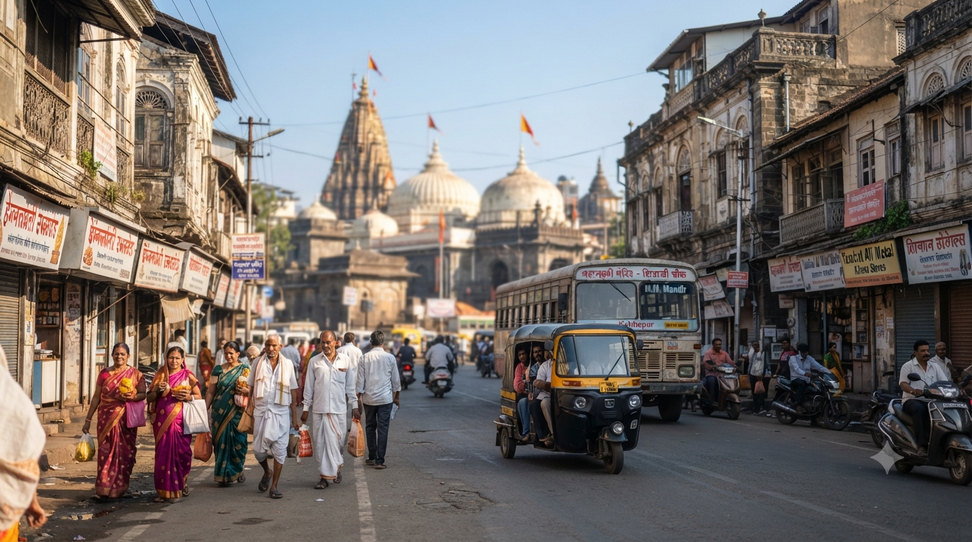
The Kolhapur Mahalaxmi temple route is straightforward once you know where to arrive and how to cover the final distance. Shri Chhatrapati Shahu Maharaj Terminus Kolhapur (KOP) is the nearest convenient railway station. Government tourism sources place it approximately 3 km from Shree Karveer Niwasini Ambabai Mahalaxmi Temple, although published distance estimates vary.
Kolhapur also has a central bus stand, an airport and good road links through Maharashtra and Karnataka. However, the temple sits in a busy old-city neighbourhood. Your final transfer may take longer during festivals, weekends or traffic restrictions.
Independence disclaimer: Temples Map is an independent pilgrimage information website. We are not affiliated with the temple management committee or any government authority. We do not accept temple bookings, travel reservations, donations or payments. Confirm official services through the relevant authorities.
Kolhapur Mahalaxmi temple route at a glance
The easiest way to plan your journey is to separate the intercity trip from the final local transfer. First reach Kolhapur by train, bus, car or flight. Then choose suitable transport towards the Ambabai Temple area.
| Arrival point | Indicative distance | Final transport |
|---|---|---|
| Kolhapur railway station (KOP) | About 3 km; published estimates vary | Auto-rickshaw or taxi |
| Kolhapur central bus stand | About 3 km | Auto-rickshaw or taxi |
| Kolhapur Airport | About 12–13 km | Taxi or authorised local transport |
| Pune | About 240 km to Kolhapur | NH48, bus or train |
| Mumbai | About 380 km to Kolhapur | Road, train or available flight |
Distance verification note: The Ministry of Tourism’s Utsav temple listing gives 3 km for the railway station and bus stand, plus 12 km for the airport. The Maharashtra Tourism temple guide lists 3 km by rail and 13 km by air in its travel-essentials section. However, another paragraph on that page describes the railway station as 5 km away and the airport as 10 km from the city centre.
Therefore, use these figures as planning estimates rather than exact driving distances. The final distance depends on your starting exit, road route and permitted temple drop-off point.
Which railway station is nearest to Kolhapur Mahalaxmi Temple?
Shri Chhatrapati Shahu Maharaj Terminus Kolhapur is the nearest convenient railway station for Mahalaxmi Temple. Its station code is KOP. The Ministry of Tourism’s Utsav listing places the station about 3 km from the shrine. However, Maharashtra Tourism contains a conflicting 5 km estimate in its descriptive text.
For planning, expect a short local road transfer rather than relying on one exact distance. The precise distance can vary with the route and any traffic restrictions near the temple.
The railway station is also known as Chhatrapati Shahu Maharaj Terminus or simply Kolhapur railway station. Travellers may encounter these variations in maps and older guides.
The Government of India’s Incredible India temple guide also identifies Chhatrapati Shahu Maharaj Terminus (KOP) as the nearest station.
From Kolhapur railway station to Mahalaxmi Temple
After arriving at KOP, most visitors can take an auto-rickshaw or taxi towards the Ambabai Temple neighbourhood. This is usually more convenient than walking with luggage or elderly family members. However, the driver may have to stop before the temple entrance during traffic restrictions.
- Leave the railway station and find an authorised local transport option.
- Tell the driver that your destination is Ambabai Mahalaxmi Temple in central Kolhapur.
- Confirm the fare or metered arrangement before starting.
- Ask for the nearest permitted temple drop-off point.
- Follow local pedestrian directions if vehicles cannot enter the surrounding streets.
Keep some extra time for the last part of the journey because old-city traffic is not always predictable. A short map distance does not guarantee a quick arrival.
Can you walk from Kolhapur railway station?
Walking may suit travellers who are comfortable covering several kilometres in an urban environment. However, a railway-to-temple walk is not ideal for everyone. Luggage, heat, rain, traffic and crowd conditions can make an auto-rickshaw more practical.
Older visitors, people with limited mobility and families with young children should consider a local vehicle. If you plan to walk, use a current pedestrian route rather than following vehicle-only directions.
Kolhapur Mahalaxmi temple route by train
The Kolhapur Mahalaxmi temple route by train is convenient when a suitable service reaches KOP. The railway station is within Kolhapur city, so the final transfer is relatively short. This makes rail especially useful for pilgrims travelling overnight.
Train schedules and route availability can change. Therefore, search your actual travel date through IRCTC before finalising your journey.
Check the train number, operating days, boarding station and arrival time. Also confirm the latest train status before departure. A connection shown in an older article may no longer operate on the same schedule.
What if there is no direct train to Kolhapur?
If a direct train to KOP is unavailable, first check alternative services and dates. Next, consider a rail connection through Miraj Junction. The Kolhapur district administration places Miraj about 50 km from Kolhapur.
From Miraj, travellers can compare an onward rail service with available road transport. However, allow enough connection time because a delayed first train can affect the rest of the journey.
Another option is to reach a nearby regional transport hub and continue by bus. The best choice depends on your origin, budget and preferred arrival time.
How far is Kolhapur bus stand from Mahalaxmi Temple?
The Ministry of Tourism’s Utsav listing places Kolhapur’s nearest convenient bus stand approximately 3 km from the temple. Most visitors can continue by auto-rickshaw or taxi. However, different bus operators may use different arrival points, so check your ticket before travelling.
The central bus stand is useful for visitors coming from Pune, Mumbai, Sangli and other nearby towns. Maharashtra State Road Transport Corporation (MSRTC) provides regional road services.
When arranging your journey, confirm the actual bus stop rather than assuming every service terminates at the same stand. This matters particularly if your bus arrives late at night.
From the bus stand to Ambabai Temple
After leaving the bus stand, tell your driver that you are going to Shree Karveer Niwasini Ambabai Mahalaxmi Temple. Most local drivers will recognise the destination. Still, share the temple location through a navigation app if necessary.
Keep in mind that road access can change during festivals. You may need to walk from a permitted drop-off area to the entrance.
Kolhapur Mahalaxmi temple route by road
The Kolhapur Mahalaxmi temple route by road is practical from Pune, Satara, Sangli, Belagavi and other regional destinations. The main Pune–Satara–Kolhapur highway corridor uses NH48. Older guides may still refer to this road as NH4.
The Maharashtra Highway Traffic Police official highway list confirms NH48 through the Pune, Satara and Kolhapur corridor towards the Karnataka border.
This distinction is useful when comparing old road guides with current navigation apps. Use NH48 as the current highway reference, then follow local directions after entering Kolhapur.
Pune to Kolhapur Mahalaxmi Temple
Maharashtra Tourism estimates Pune to Kolhapur at approximately 240 km by road. The principal route follows NH48 south through the Satara corridor. However, your full journey also includes the final transfer from the city approach to the temple area.
The official Maharashtra Tourism Mahalaxmi Temple page provides the Pune distance estimate.
Road travel time depends on departure time, traffic, weather and construction activity. Therefore, check current conditions before leaving Pune, particularly during busy holiday periods.
Mumbai to Kolhapur Mahalaxmi Temple
Maharashtra Tourism gives approximately 380 km for the Mumbai-to-Kolhapur road journey. Travellers generally approach the Pune corridor before continuing towards Satara and Kolhapur on NH48.
The 380 km figure is a broad travel-planning estimate, not a fixed distance from every Mumbai neighbourhood. Your actual journey varies according to the starting point and route.
For a family pilgrimage, include meal breaks and rest stops in your schedule. It is also wise to leave a buffer before any fixed temple ritual.
From Sangli, Solapur and Karnataka
Kolhapur has regional road connections towards Sangli and Solapur in the east. The district administration also identifies connections towards Belagavi and Bengaluru in the south. Western routes connect towards Ratnagiri and Sindhudurg.
These links make Kolhapur suitable for a multi-destination Maharashtra or Karnataka pilgrimage. However, the best road depends on where your journey begins.
Check navigation and current highway conditions before travelling. During heavy monsoon weather, additional caution may be necessary on routes passing through hilly areas.
Parking near Kolhapur Mahalaxmi Temple
Kolhapur Municipal Corporation lists several city parking locations relevant to temple visitors. These include Mahalaxmi Temple Parking, Kapil Tirth Market Parking and Bindu Chowk Parking. However, a published parking location does not guarantee an available space on your arrival date.
Check the Kolhapur Municipal Corporation official parking list before driving into the central area.
Parking charges, operating arrangements, vehicle restrictions and capacity may change. Therefore, follow current municipal information and directions displayed at the parking facility.
There is no verified permanent parking arrangement that should be assumed for every Navratri celebration. Kolhapur Police’s Traffic Branch prepares special traffic arrangements for festivals and important events. These can affect vehicle entry, exits and access to usual parking areas.
Before travelling during Navratri or Kirnotsav, check the Kolhapur Police Traffic Branch for current instructions.
Do not treat an ordinary-day parking list as a festival traffic notice. When officers redirect traffic, follow the temporary arrangements even if your navigation app shows another route.
What if parking is full?
If your preferred parking location is full, follow instructions towards another authorised facility. Avoid stopping on narrow roads or blocking local access. This can cause inconvenience and may lead to enforcement action.
If you are travelling with elderly visitors, plan for the possibility of a longer walk. Where permitted, arrange a suitable passenger drop-off before parking your vehicle.
Kolhapur Mahalaxmi temple route by air
The Kolhapur Mahalaxmi temple route by air uses Kolhapur Airport, also known as Chhatrapati Rajaram Maharaj Airport. Official tourism sources provide slightly different distance estimates. The Ministry of Tourism’s Utsav listing gives 12 km, while Maharashtra Tourism’s travel-essentials section gives 13 km.
For planning, treat the airport-to-temple distance as approximately 12–13 km. This is not a guaranteed driving distance because the selected road and drop-off point can affect the total.
Travellers can use a suitable authorised taxi or local transport option from the airport. However, confirm transport availability around your arrival time, especially for early or late flights.
Does Kolhapur Airport have direct flights from every major city?
No. Direct flight availability depends on the airline, route and travel date. The Airports Authority of India Kolhapur flight schedule describes its schedule information as tentative.
Therefore, check the current service directly with the operating airline before making a payment. A flight listed in an older travel guide may have changed its frequency, timing or operating status.
Alternative airports near Kolhapur
If a convenient Kolhapur flight is unavailable, compare Belagavi and Pune airports. The Kolhapur district administration estimates Belagavi Airport at approximately 125 km from the city and Pune Airport at about 250 km.
Mumbai Airport is another possibility, although the district administration places it approximately 380 km away. This usually involves a much longer road journey.
Compare the full door-to-door trip rather than the airfare alone. Sometimes a train to KOP or a road journey from Pune will be simpler than flying to a distant airport.
Which transport option is best for Mahalaxmi Temple?
The best choice depends on your starting city, travel date and mobility needs. A convenient train to KOP often simplifies the final transfer. Road travel offers more flexibility for regional trips, while a suitable direct flight may save time for distant travellers.
| Transport | Best suited for | Main consideration |
|---|---|---|
| Train to KOP | Visitors with a convenient direct train | Short local transfer after arrival |
| MSRTC or other bus | Regional road travellers | Confirm the actual bus drop-off point |
| Private car | Families and multi-stop trips | Parking and festival restrictions |
| Flight to Kolhapur | Travellers with suitable air connections | Schedule changes and airport transfer |
If your train reaches KOP at a convenient time, rail can be the most straightforward option. However, a family planning several regional stops may prefer road travel.
Air travel is worth comparing when it avoids a very long journey. Still, include airport reporting time and ground transport before deciding.
Plan your arrival around temple darshan
The Kolhapur Mahalaxmi temple route should also fit your intended darshan time. Reaching the city does not mean reaching the temple immediately. Traffic, queue conditions and pedestrian access can affect your schedule.
Review our Kolhapur Mahalakshmi Temple darshan timings guide before choosing a train, bus or flight arrival time.
If you plan to attend a specific ritual, read the Kolhapur Mahalaxmi Temple Abhishekam guide. Confirm current procedures through the official temple authority because schedules and access rules may change.
Travellers planning several temple visits can also consult our famous temples in Maharashtra guide to organise destinations geographically.
Common route planning mistakes
Some visitors rely on a single distance figure without checking its origin. For example, the Ministry of Tourism and Maharashtra Tourism publish different railway-station estimates in parts of their listings. Treat such distances as indicative and check your live route.
- Using the old NH4 label: NH48 is the current official reference for the main Pune–Kolhapur highway corridor.
- Assuming parking will be available: Municipal parking lists do not guarantee a free space during festivals.
- Using old flight information: Airline schedules and routes can change.
- Confusing Miraj with Kolhapur: Miraj Junction is a secondary rail hub, not the nearest railway station.
- Planning a tight connection: Local traffic can delay the last transfer even after a train arrives on time.
- Ignoring walking requirements: A permitted drop-off point may be some distance from the temple entrance.
These mistakes are easy to avoid when you check official information before departure. Leave time for small changes rather than planning every step around an exact arrival minute.
Official sources for route verification
Use official sources to confirm information that can change. The following links cover the main questions for this route:
- Maharashtra Tourism – Mahalaxmi Temple: Pune and Mumbai distances, airport access and temple travel information.
- Ministry of Tourism Utsav – Ambabai Temple: indicative station, bus-stand and airport distances.
- Maharashtra Highway Traffic Police – List of Highways: current NH48 identification.
- Kolhapur District Administration – How to Reach: regional rail, road and airport connections.
- Kolhapur Municipal Corporation – Parking List: municipal parking locations.
- Kolhapur Police – Traffic Branch: traffic management and festival arrangements.
- Airports Authority of India – Kolhapur Schedule: flight-schedule reference.
For temple-specific notices, consult the official Ambabai Mahalaxmi Temple website. These references are more reliable than unsourced travel estimates copied from older pages.
Before you leave for Kolhapur
The Kolhapur Mahalaxmi temple route is easiest when you plan the last local transfer as carefully as the intercity journey. KOP railway station and the central bus stand are close to the temple, while the airport requires a longer road transfer. Use the official distance figures as estimates, not guarantees.
For road travel, NH48 is the current highway reference from Pune through Satara towards Kolhapur. If you are driving during a major festival, check current police restrictions and parking guidance. Carry water and necessary medication, and allow extra time if travelling with elderly family members.
Frequently asked questions
What is the nearest railway station to Kolhapur Mahalaxmi Temple?
Shri Chhatrapati Shahu Maharaj Terminus Kolhapur (KOP) is the nearest convenient railway station. The Ministry of Tourism lists approximately 3 km to the temple. However, Maharashtra Tourism also publishes a 5 km estimate in one section, so check the actual route before departure.
How do I reach Mahalaxmi Temple from KOP railway station?
Take an authorised auto-rickshaw or taxi towards the Ambabai Temple area. Confirm the fare and nearest permitted drop-off point first. You may need to walk the final stretch during traffic restrictions.
How far is Kolhapur bus stand from Mahalaxmi Temple?
The Ministry of Tourism’s Utsav listing gives approximately 3 km from the nearest convenient bus stand. However, your actual distance may differ if your operator uses another stopping point.
How far is Kolhapur Airport from Mahalaxmi Temple?
Government tourism references place the airport about 12–13 km from the shrine. This range reflects different published estimates, so confirm the live road route and final drop-off location.
Is the Pune to Kolhapur highway NH4 or NH48?
NH48 is the current official designation. Maharashtra Highway Traffic Police lists the corridor through Pune, Satara and Kolhapur as NH48. NH4 remains common in older travel articles.
How far is Pune from Kolhapur Mahalaxmi Temple?
Maharashtra Tourism estimates Pune to Kolhapur at around 240 km. The exact journey to the temple depends on your starting point, selected route and local access conditions.
How far is Mumbai from Kolhapur Mahalaxmi Temple?
Maharashtra Tourism gives an approximate Mumbai-to-Kolhapur distance of 380 km. This is a general road-planning figure. Actual travel distance and time depend on the departure location and traffic.
Is parking available near Mahalaxmi Temple?
Kolhapur Municipal Corporation lists several relevant parking locations, including Mahalaxmi Temple Parking and Kapil Tirth Market Parking. However, availability and access can change, particularly during festivals.
Do not assume normal parking arrangements will remain unchanged. Kolhapur Police may introduce special traffic routes, entry restrictions and parking instructions. Check current official notices before driving into the temple neighbourhood.
What if there is no direct train to Kolhapur?
Compare other KOP services first. Miraj Junction is another possible rail connection, approximately 50 km from Kolhapur according to the district administration. You can also compare onward road transport.
Is train or flight better for the Kolhapur Mahalaxmi temple route?
A convenient train to KOP often means a shorter final transfer. Flying may save time from some distant cities, but flight availability and the airport road transfer must also be considered. Compare your total door-to-door journey.